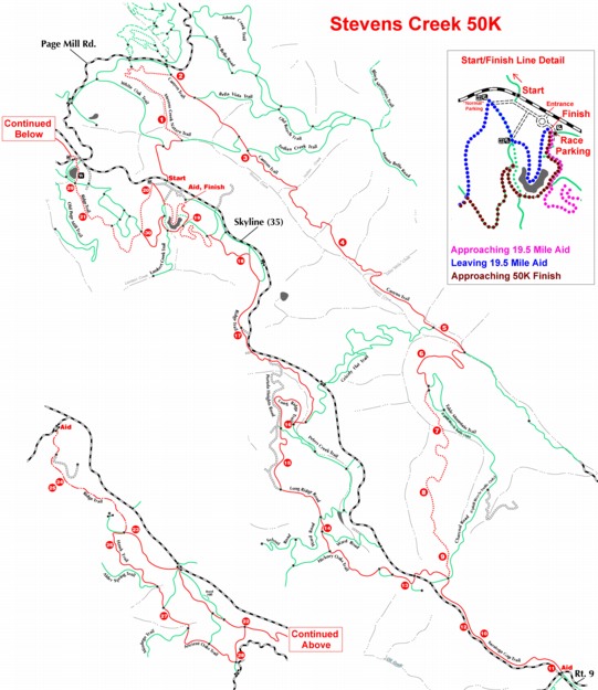

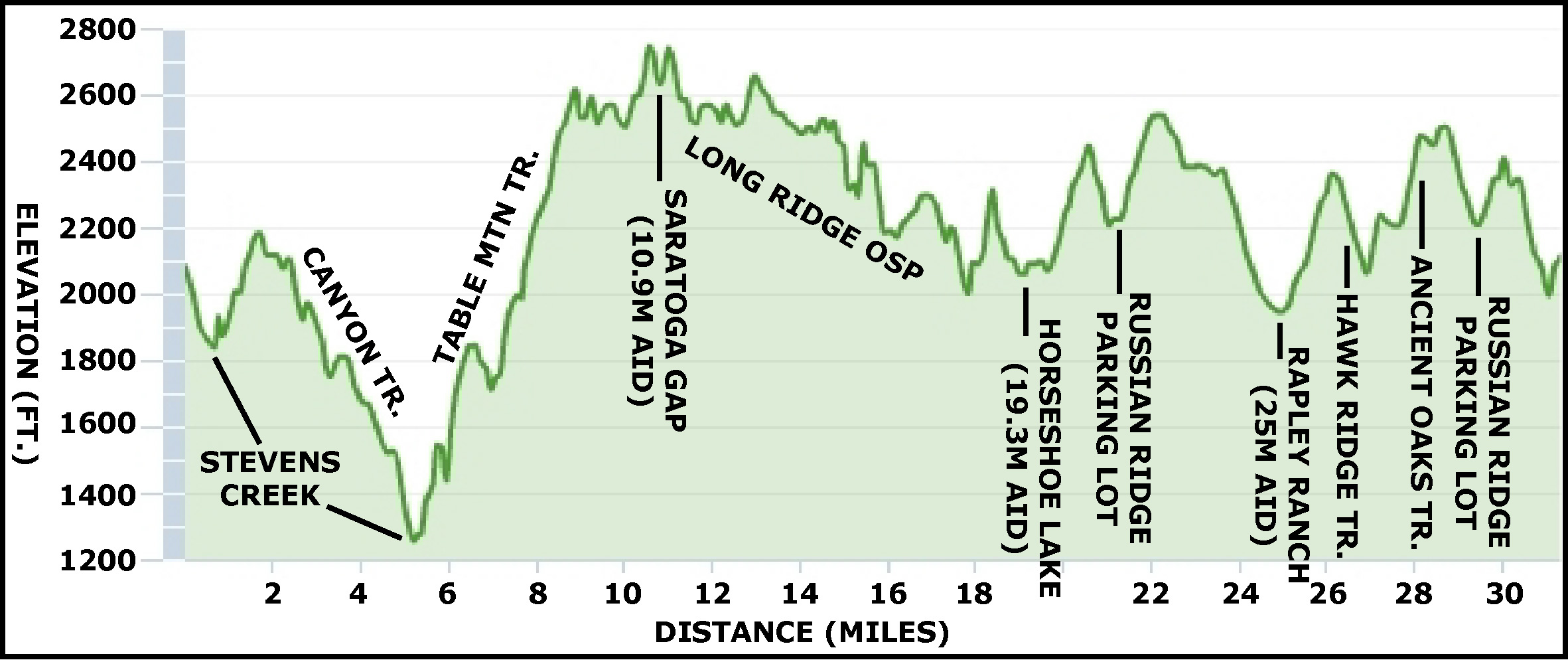
For a text-only version of the route, click here.
Items in bold are the key turns or possibly tricky intersections
BART = Bay Area Ridge Trail
|
Trail |
Distance to Next |
Ascent-Descent |
Instruction at end of segment |
Note |
Picture |
| Start, Skyline Ridge parking lot, down Skid Road Trail |
0.32 (0.32) |
0-240 |
STRAIGHT (past White Oak Tr. branching to left) | ||
| Skid Road Tr. |
0.28 (0.60) |
0-80 |
LEFT on Stevens Creek Nature Tr. | ||
| Stevens Creek Nature Tr. |
1.07 (1.67) |
420-20 |
RIGHT at stone bench at top of climb | After a short portion of this segment cross Stevens Creek for the first time (probably dry) | |
| - |
0.28 (1.95 |
0-100 |
RIGHT on Canyon Tr. | ||
| Canyon Tr. |
0.21 (2.16) |
0-20 |
STRAIGHT past Bella Vista Tr. forking to left | ||
| Canyon Tr. |
0.55 (2.71) |
40-240 |
STRAIGHT past Stevens Creek Nature Tr. branching to right | ||
| Canyon Tr. |
0.26 (2.97) |
50-50 |
STRAIGHT/RIGHT past Indian Creek Tr. forking uphill to left | ||
| Canyon Tr. |
1.97 (4.94) |
140-660 |
STRAIGHT past Grizzly Flat Tr. branching to right | ||
| Canyon Tr. |
0.32 (5.26) |
0-120 |
RIGHT on Table Mtn. Tr. | ||
| Table Mtn. Tr. |
1.27 (6.53) |
620-0 |
RIGHT on Table Mtn. fireroad | Cross Stevens Creek at the beginning of this segment (possibly wet) | |
| Table Mtn. Fireroad |
0.06 (6.59) |
10-0 |
RIGHT on Charcoal Flat Tr. | ||
| Charcoal Flat Tr. |
2.67 (9.26) |
700-60 |
DIAGONAL across clearing on Saratoga Gap Tr. Do not take fireroad straight uphill (leading to Skyline Blvd.) |
Bypass several perpendicular spurs near the top of this segment | |
| Saratoga Gap Tr. |
1.65 (10.91) |
240-40 |
TURNAROUND at Saratoga Gap | Do not cross road; aid station expected on the N side of Rt. 9. | |
| Saratoga Gap Tr. |
1.65 (12.56) |
40-240 |
STRAIGHT across clearing | ||
| Bay Area Ridge Trail (BART) |
0.35 (12.91) |
20-20 |
STRAIGHT across Skyline Blvd. to Long Ridge OSP | Careful - road crossing! | |
| BART |
0.22 (13.12) |
80-0 |
STRAIGHT keeping on fireroad where BART trail (short loop) branches to left | At the top of the first hill, go right (very short spur goes to the left). | |
| BART (fireroad) |
0.10 (13.22) |
0-0 |
STRAIGHT past Bay Area Ridge Tr. coming back in on left | Open vistas to west for the next several miles | |
| BART |
0.60 (13.82) |
40-140 |
STRAIGHT/RIGHT onto a singletrack trail at a point where the fireroad you are on turns sharply left and downhill | ||
| BART |
0.21 (14.03) |
20-0 |
STRAIGHT/MERGE onto "Ward Rd." (firetrail) coming in from right | ||
| BART/Long Ridge Tr. |
0.10 (14.13) |
0-0 |
STRAIGHT past Peters Creek Tr. heading into woods on right | ||
| BART/Long Ridge Tr. |
0.46 (14.59) |
40-40 |
RIGHT into woods onto Peters Creek Tr. | ||
|
Trail |
Distance to Next |
Ascent/Descent |
Instruction at end of segment |
Note |
Picture |
| Peters Creek Tr. |
0.74 (15.33) |
40-60 |
STRAIGHT across clearing past trail coming in from right rear | ||
| Peters Creek Tr. |
0.68 (16.01) |
80-200 |
LEFT at the bottom of very steep hill | ||
| - |
0.10 (16.11) |
0-20 |
LEFT on Bay Area Ridge Tr. | Trail to the right leads to Grizzly Flat trailhead | |
| BART |
0.94 (17.05) |
160-0 |
LEFT (staying on BART) in a clearing | ||
| BART |
0.70 (17.75) |
40-200 |
LEFT (again staying on BART) onto dirt/gravel road that runs through Christmas Tree Farm | ||
| BART |
0.60 (18.35) |
120-200 |
LEFT onto BART at top of steep hill (over chained gate) | During this section, the road forks several times; always take the left fork, staying to the rear of the Tree Farm (keep the Christmas trees on your right) | |
| BART |
0.04 (18.39) |
20-0 |
LEFT onto BART | ||
| BART |
0.55 (18.94) |
40-80 |
LEFT onto fireroad and then immediate RIGHT onto trail circling lake counterclockwise | ||
| - |
0.32 (19.26) |
20-0 2980-2930 total (?) |
When you reach the parking lot, straight (curving left) on unmarked trail heading uphill | AID STATION (and subsequent finish) | |
| - |
0.24 (19.50) |
80-0 |
Previous aid station and finish | ||
| - |
0.13 (19.63) |
0-60 |
DIAGONAL LEFT across gravel road | ||
|
0.21 (19.84) |
0-0 |
LEFT uphill where the trail reaches the parking lot | |||
| BART |
0.47 (20.31) |
240-0 |
STRAIGHT across fireroad at top of hill | ||
| BART |
0.34 (20.65) |
100-20 |
STRAIGHT past minor spur to right |
|
|
| BART |
0.62 (21.27) |
160-40 |
RIGHT around Alpine Pond counterclockwise, and immediate right at the first fork (do NOT take trail closest to pond) |
Steve Patt's picture appeared in Runner's World Magazine "Rave Run" feature on this section of trail |
 |
| BART |
0.03 (21.30) |
0-0 |
Left at fork | ||
| BART |
0.14 (21.44) |
0-0 |
STRAIGHT through underpass under Alpine Rd., and slant left across lot to trail | ||
| BART |
0.55 (21.99) |
230-0 |
STRAIGHT past trail coming in on left |  |
|
| BART |
0.24 (22.23) |
30-0 |
LEFT on BART trail forking to left | Previous route went straight at this point and this went up Borel Hill; this is a change in 2006 | |
| BART |
0.61 (22.84) |
0-240 |
LEFT on fireroad just before the trail ends | ||
| BART |
0.01 (22.85) |
40-240 |
STRAIGHT on BART | ||
| BART |
0.64 (23.49) |
100-40 |
RIGHT on BART | ||
| BART |
1.13 (24.62) |
20-200 |
LEFT on gravel road | ||
| BART |
0.24 (24.86) |
20-20 |
TURNAROUND at Rapley Ranch Rd. | AID STATION | |
| BART |
0.24 (25.10) |
20-20 |
RIGHT onto trail | Easy turn to miss | |
| BART |
1.13 (26.23) |
200-20 |
RIGHT onto Hawk Ridge Tr. | ||
| Hawk Ridge Tr. |
0.57 (26.80) |
0-340 |
STRAIGHT past trail coming in from right | ||
| Hawk Ridge Tr. |
0.47 (27.27) |
200-40 |
STRAIGHT past trail coming in from left | ||
| Hawk Ridge Tr. |
0.30 (27.57) |
20-80 |
FORK LEFT onto Ancient Oaks Tr. | Don't take Mindego Tr. To right | |
| Ancient Oaks Tr. |
0.45 (28.02) |
280-0 |
STRAIGHT past trail going to left | 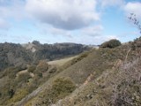 |
|
| Ancient Oaks Tr. |
0.28 (28.30) |
80-40 |
LEFT on trail | ||
| Ancient Oaks Tr. |
0.31 (28.61) |
160-0 |
RIGHT onto BART | ||
| BART |
0.55 (29.16) |
0-230 |
DIAGONAL across parking lot and through underpass | ||
| BART |
0.17 (29.33) |
0-0 |
FORK LEFT onto BART | ||
| BART |
0.62 (29.95) |
40-160 |
STRAIGHT past minor spur to left | ||
|
0.34 (30.29) |
20-100 |
RIGHT onto fireroad | 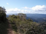 |
||
|
0.45 (30.74) |
0-240 |
RIGHT at the next fireroad | |||
|
0.05 (30.79) |
0-0 |
STRAIGHT over bridge | |||
|
0.05 (30.82) |
0-0 |
LEFT onto trail continuing around lake | |||
|
0.32 (31.14) |
5020-4820 total |
FINISH at parking lot |